Download & Play US Public Lands on PC & Mac with NoxPlayer (Emulator)
gameIcon

US Public Lands on PC

Installs  10000
Download NoxPlayer, play US Public Lands with a big screen - an unparalleled gaming experience

Play US Public Lands on PC with NoxPlayer

Details

Last Update :  2023-05-31        Current Version :  2022.11
The US Federal Government* owns nearly 650 million acres of land almost 30 percent of the land area of the United States.

These are lands that are held for all Americans.

Up until now, there has been no quick & easy way to retrieve the boundaries of these properties without carrying physical maps, books, or slowly digging deep online.

Included in this app are on device (fully works offline), individually selectable & beautifully colored layers for most of the properties administered by the federal government:

Bureau of Land Management (BLM)
US Forest Service (FS)
National Park Service (NPS)
Army Corp of Engineers (ACOE)
US Fish & Wildlife Service
Bureau of Reclamation
Tennessee Valley Authority
Department of Defense (military bases & installations)
Other (National Laboratories, Test Sites, etc...)

Key Benefits & Features

Know which US agency owns and operates the land you're on or are heading to. Use the "Layers" icon to select which agencies you want displayed to create your own custom map. (Hint, the toggles are color coded to the color each layer is displayed in.)

Links are provided to each agency's website within the app, so that you can further your research as to what land use rules apply for each public land type such as permits, fees, activities allowed, and limits of stay.

Map layers are stored on device no internet connection required.

Be sure to turn on the 'Basic' base map to see the US Public Land labels for each land area. This base map layer is also stored entirely on your device, and can be utilized if you do not have an internet connection or would like to conserve bandwidth.

If you have an internet connection, you can utilize standard and satellite view maps as well as the base layer underneath the public land overlays.

A boondocker's assistant While US Public Lands is not specifically a camp site locator and does not have a database of specific sites, by turning on the satellite view map, you can better scout out trails, roads and signs of dispersed camping locations within the boundaries of the public land resources.

Quickly toggle between 'Show' and 'Hide' via the "Map" icon to more clearly see satellite images below.

If you have GPS access on your device, click the 'Locate Me' icon to show your present location know what type of land you're on right now!

Built in search tool locates anything on device maps supports (requires internet access) including cities, states, zip codes, addresses and points of interest. A pin is dropped at the search location.

*The maps included in this app were generated from data provided by the Protected Area Database (PADUS) of the U.S. Geological Survey* (https://www.usgs.gov/programs/gapanalysisproject/science/padusdataoverview). We would like to thank them for providing the public domain raw map data that we’ve been able to utilize to create this interactive overlayable mapping & navigation tool. We will update our maps in the future to stay in sync with improvements to this data set.

Two Steps Beyond is not affiliated with, and does not represent, the USGS or any other US Government Agency.

Please note, the USGS PADUS database contains the “most uptodate aggregation of Federal lands and waters” available, but this database is still evolving and some locations may not be listed and others may not have precisely accurate boundaries. Resolution across the nation may vary. And always remember there may be private unmapped inholdings within any public lands so always pay attention to local signage, indications, and information.

The US Public Lands app should only be used as an overview, and you should always confirm more precise details by consulting local field offices, administration websites, and other resources. Do not solely rely on this app for determining if you are on public or private land.
arrowIcon

How to play US Public Lands on PC using NoxPlayer

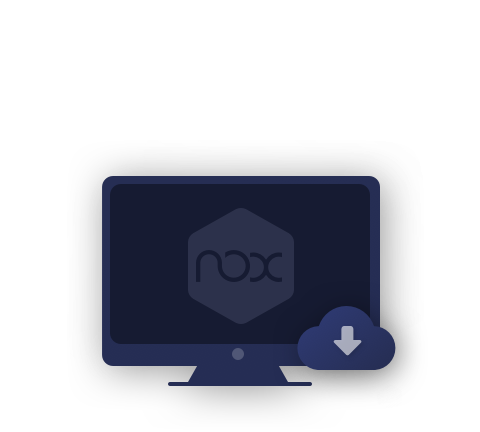
  • 1Download NoxPlayer on your PC.

  • 2Run the installation package and complete the installation.

  • 3Search for US Public Lands on NoxPlayer.

  • 4Install the game in Google Play.

  • 5Click the game icon to start it.

  • 6Play US Public Lands with NoxPlayer on PC easier!

Simple Method

Method 1. Click "Download on PC" to download NoxPlayer and apk file at the same time. Once installation completes, play the game on PC.

Method 2. If you already have NoxPlayer on PC, click "Download APK", then drag and drop the file to the emulator to install.

The Wonderful Video of US Public Lands

Do you wanna run US Public Lands with a better gaming experience? With the benefit of the bigger screen, smarter keyboard and the higher hardware performance, NoxPlayer brings you an extreme gaming experience on PC. By downloading and playing US Public Lands on PC via NoxPlayer, users don't need to worry about the battery or the interruption of calling.
NoxPlayer is compatible with Android 7 and supports running over 90% of the mobile games on PC, which will boost your gaming experience perfectly. In addition, by opening multiple instances, Noxplayer supports to running multiple games or apps at the same time, or chatting with your friend while playing game.
NoxPlayer is perfectly compatible with AMD and Intel with the exclusive core virtualization technology, making your computer run more stable and smoothly. Download NoxPlayer and experience it now!

Popular Games

closeIcon
computerIcon

Please download with PC browser

NoxPlayer is designed for Windows and MAC OS, please visit this website via computer browser to download NoxPlayer.